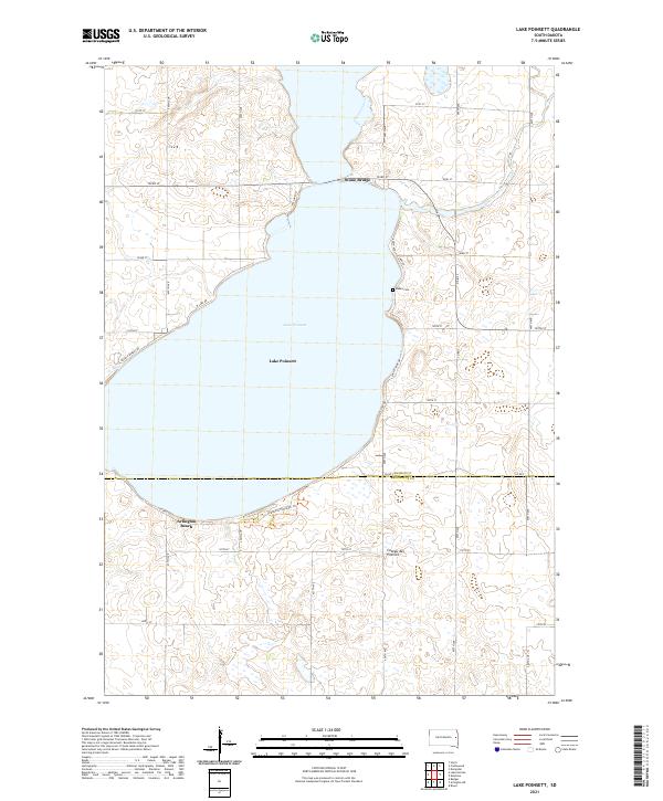
2021 Map of Lake Poinsett
USGS Topo · Published 2021About this map
Lake Poinsett dominates this part of the Coteau des Prairies, a high plateau known for its dense clusters of glacial lakes and wetlands. The shoreline is characterized by small lakeside clusters such as Arlington Beach on the southern bank and the crossing at Stone Bridge to the north. These settlements represent the long-standing recreational and residential use of the glacial waters within Hamlin County and Brookings County. Away from the water, the grid of section lines and county roads, including Co Rd 7, reveals a strictly managed agricultural landscape typical of the eastern South Dakota plains. For those researching local history, the Bakke Cem serves as a lone memorial marker along the eastern shore, positioned between the lake and the numerous small prairie potholes that dot the surrounding terrain.
Find a feature on this map
33 named features on this map. Tap any name to fly to it.
Don’t see what you’re looking for? This feature index may not catch every label — zoom into the map to look around manually.
Map Details
Editions of this 2021 Lake Poinsett Map
This is the sole edition of this map. No revisions or reprints were ever made.
Other maps of this area

1953 · Watertown
USGS Topo · 1:250,000

1958 · Watertown
USGS Topo · 1:250,000

1968 · Bruce
USGS Topo · 1:24,000

1968 · Arlington NE
USGS Topo · 1:24,000

1968 · Badger
USGS Topo · 1:24,000

1969 · Hayti
USGS Topo · 1:24,000

1969 · Dempster
USGS Topo · 1:24,000

1969 · Castlewood
USGS Topo · 1:24,000

1969 · Lake Norden
USGS Topo · 1:24,000

1969 · Lake Poinsett
USGS Topo · 1:24,000