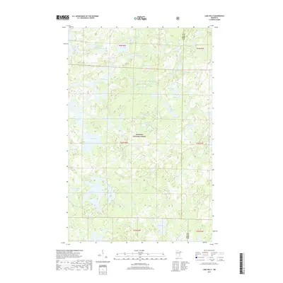
2019 Map of Lake Polly
USGS Topo · Published 2019About this map
The Superior National Forest dominates this northern wilderness landscape, defined by a dense network of glacial lakes and river systems. The Louse River meanders through the central terrain, connecting several prominent water bodies including Malberg Lake and Bowstring Lake. This 2019 survey illustrates the intricate hydrography of the region, where numerous named lakes such as Kivandeba Lake, Wapata Lake, and Coot Lake are separated by narrow land bridges and marshy depressions. The map also delineates the jurisdictional boundary between Lake County and Cook County, which bisects the eastern portion of the quadrangle. With no major roads or permanent settlements indicated, the map highlights the primitive character of this protected forest area, providing essential detail for navigating the interconnected waterways like Koma Lake and Trail Lake.
Find a feature on this map
48 named features on this map. Tap any name to fly to it.
Don’t see what you’re looking for? This feature index may not catch every label — zoom into the map to look around manually.
Map Details
Editions of this 2019 Lake Polly Map
This is the sole edition of this map. No revisions or reprints were ever made.
Other maps of this area

1954 · Two Harbors
USGS Topo · 1:250,000

1957 · Two Harbors
USGS Topo · 1:250,000

1957 · Quetico
USGS Topo · 1:250,000

1958 · Two Harbors
USGS Topo · 1:250,000

1959 · Ogishkemuncie Lake
USGS Topo · 1:24,000

1959 · Kekekabic Lake
USGS Topo · 1:24,000

1959 · Gillis Lake
USGS Topo · 1:24,000

1960 · Lake Polly
USGS Topo · 1:24,000

1960 · Kawishiwi Lake
USGS Topo · 1:24,000

1960 · Perent Lake
USGS Topo · 1:24,000