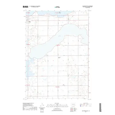
2017 Map of Lake Preston East
USGS Topo · Published 2017About this map
Lake Whitewood dominates the central landscape of this Kingsbury County region, situated atop the distinctive Coteau des Prairies highland. This topographic study captures the town of Lake Preston as it is integrated into a strictly defined section-line grid of rural roads like 444th Ave and 212th St. The northern reaches of the map show the Lake Preston Lakebed, indicating the ephemeral nature of water bodies in this prairie environment. Local history is anchored by the United Cem located in the southern portion of the quadrangle, serving the surrounding agricultural community. The terrain is marked by numerous small depressions and wetlands typical of the glaciated plains, with the municipal streets of Lake Preston such as 1st St NE and Park Ave S transitioning into the vast open fields that characterize this portion of South Dakota.
Find a feature on this map
29 named features on this map. Tap any name to fly to it.
Don’t see what you’re looking for? This feature index may not catch every label — zoom into the map to look around manually.
Map Details
Editions of this 2017 Lake Preston East Map
This is the sole edition of this map. No revisions or reprints were ever made.
Other maps of this area

1953 · Watertown
USGS Topo · 1:250,000

1958 · Watertown
USGS Topo · 1:250,000

1968 · Lake Preston East
USGS Topo · 1:24,000

1968 · Lake Preston West
USGS Topo · 1:24,000

1968 · Lake Preston NE
USGS Topo · 1:24,000

1968 · Oldham NW
USGS Topo · 1:24,000

1968 · Arlington
USGS Topo · 1:24,000

1968 · Erwin
USGS Topo · 1:24,000

1968 · Oldham
USGS Topo · 1:24,000

1968 · Badger
USGS Topo · 1:24,000