
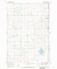
1968 Map of Lake Preston East
USGS Topo · Published 1970About this map
Lake Preston serves as the focal point for this eastern Kingsbury County study, situated at the intersection of a significant regional transportation network during the late 1960s. The landscape is dominated by glacial aquatic features, including the sprawling Whitewood Lake and the marshy expanses of Spring Lake and the Lake Preston Lakebed. The town itself is a notable rail junction, where the Chicago and North Western line crosses the Chicago Milwaukee St Paul and Pacific railroad, illustrating the importance of rail transit to the South Dakota prairie economy.
Find a feature on this map
15 named features on this map. Tap any name to fly to it.
Don’t see what you’re looking for? This feature index may not catch every label — zoom into the map to look around manually.
Map Details
Editions of this 1968 Lake Preston East Map
This is the sole edition of this map. No revisions or reprints were ever made.
Other maps of this area

1953 · Watertown
USGS Topo · 1:250,000

1958 · Watertown
USGS Topo · 1:250,000

1968 · Lake Preston West
USGS Topo · 1:24,000

1968 · Lake Preston NE
USGS Topo · 1:24,000

1968 · Oldham NW
USGS Topo · 1:24,000

1968 · Arlington
USGS Topo · 1:24,000

1968 · Erwin
USGS Topo · 1:24,000

1968 · Oldham
USGS Topo · 1:24,000

1968 · Badger
USGS Topo · 1:24,000
1968 · Madison NW
USGS Topo · 1:24,000