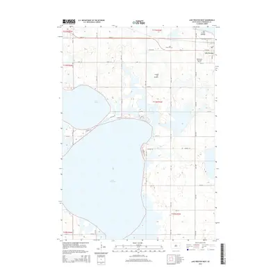
2015 Map of Lake Preston West
USGS Topo · Published 2015About this map
The town of Lake Preston anchors this Kingsbury County landscape, situated on the edge of the glacial Coteau des Prairies plateau. This region is defined by its massive water bodies, including the expansive Lake Thompson and Lake Henry. The map reveals the local infrastructure supporting these lakes, such as Twin Lakes Rd and N Shore Rd, while the northern portion of the township shows the transition from the settlement center to the Lake Preston Lakebed. The rural grid is dotted with landmarks essential to local heritage, such as the Lake Preston Cem and the Lake Preston Municipal Airport. This survey provides a clear view of the section lines and township boundaries, including t110n r55w, that have governed land ownership in this part of South Dakota for generations.
Find a feature on this map
29 named features on this map. Tap any name to fly to it.
Don’t see what you’re looking for? This feature index may not catch every label — zoom into the map to look around manually.
Map Details
Editions of this 2015 Lake Preston West Map
This is the sole edition of this map. No revisions or reprints were ever made.
Other maps of this area

1899 · De Smet
USGS Topo · 1:125,000

1953 · Watertown
USGS Topo · 1:250,000

1958 · Watertown
USGS Topo · 1:250,000

1968 · Lake Preston East
USGS Topo · 1:24,000

1968 · Lake Preston West
USGS Topo · 1:24,000

1968 · Lake Preston NE
USGS Topo · 1:24,000

1968 · Oldham NW
USGS Topo · 1:24,000

1968 · Erwin
USGS Topo · 1:24,000

1968 · Oldham
USGS Topo · 1:24,000

1971 · Howard NE
USGS Topo · 1:24,000