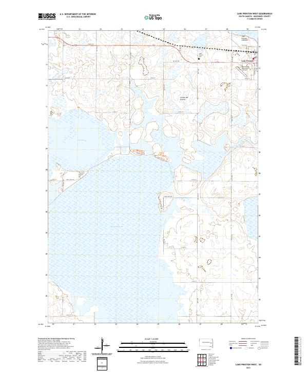
2021 Map of Lake Preston West
USGS Topo · Published 2021About this map
Lake Thompson and Lake Henry dominate this portion of the Kingsbury County landscape, illustrating the water-rich topography of the Coteau des Prairies upland. The city of Lake Preston is situated in the northeast, serving as a focal point for the region's transport and aviation via the Lake Preston Municipal Airport. A network of rural section-line roads, including Twin Lakes Rd and Goose Neck Rd, connects isolated farmsteads across the prairie. The presence of the Lake Preston Lakebed suggests a dynamic hydrologic environment where water levels fluctuate significantly over time. Local history is anchored by the Lake Preston Cem, while recreational access is highlighted by the Park Tour Trl and Flood Club Rd near the lake margins.
Find a feature on this map
29 named features on this map. Tap any name to fly to it.
Don’t see what you’re looking for? This feature index may not catch every label — zoom into the map to look around manually.
Map Details
Editions of this 2021 Lake Preston West Map
This is the sole edition of this map. No revisions or reprints were ever made.
Other maps of this area

1899 · De Smet
USGS Topo · 1:125,000

1953 · Watertown
USGS Topo · 1:250,000

1958 · Watertown
USGS Topo · 1:250,000

1968 · Lake Preston East
USGS Topo · 1:24,000

1968 · Lake Preston West
USGS Topo · 1:24,000

1968 · Lake Preston NE
USGS Topo · 1:24,000

1968 · Oldham NW
USGS Topo · 1:24,000

1968 · Erwin
USGS Topo · 1:24,000

1968 · Oldham
USGS Topo · 1:24,000

1971 · Howard NE
USGS Topo · 1:24,000