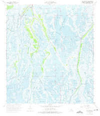
1964 Map of Lake Quitman
USGS Topo · Published 1975About this map
Dulac serves as the focal point of this coastal landscape, situated where the Houma Navigation Canal cuts through the marshy expanse of Terrebonne Parish. The community life of the mid-1960s is evidenced by local landmarks such as Dulac Sch, Cure D'ars Chapel, and L'eglise de Dieu, alongside a local Cem. The region's intricate hydrology is defined by a network of natural and man-made waterways, including Petit Caillou Bayou, Bayou Terrebonne, and the Lapeyrouse Canal. These routes facilitate access to significant water bodies like Lake Quitman and Lake Lapeyrouse. This survey records the heavy industrial footprint of the era, dominated by an extensive Oil and Gas Field and numerous Oil Wells scattered across the wetlands, illustrating the synthesis of traditional bayou navigation with the modern energy economy.
Find a feature on this map
41 named features on this map. Tap any name to fly to it.
Don’t see what you’re looking for? This feature index may not catch every label — zoom into the map to look around manually.
Map Details
Editions of this 1964 Lake Quitman Map
3 editions found
Other maps of this area

1894 · Bayou De Large
USGS Topo · 1:62,500

1894 · Dulac
USGS Topo · 1:62,500

1935 · Cocodrie
USGS Topo · 1:31,680

1935 · Theriot
USGS Topo · 1:31,680

1935 · Bourbeux
USGS Topo · 1:31,680

1935 · Montegut
USGS Topo · 1:31,680

1935 · Lake Quitman
USGS Topo · 1:31,680

1935 · Lake Gero
USGS Topo · 1:31,680

1940 · Bayou Du Large
USGS Topo · 1:62,500

1941 · Bayou Du Large
USGS Topo · 1:62,500