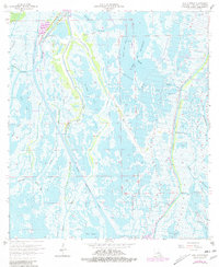
1964 Map of Lake Quitman
USGS Topo · Published 1981About this map
Grand Caillou and Petit Caillou define the water-bound geography of this Terrebonne Parish landscape, where the marshy terrain is bisected by the straight line of the Houma Navigation Canal. Small coastal religious outposts like l'Eglise de Dieu and the Cure D'ars Chapel stand near the waterways, serving a landscape shaped by the oil and gas field operations that have expanded into the wetlands. This 1964 survey captures a moment when traditional bayou life and commercial extraction intersected among features like Lake Quitman and the Indian Mound Cem. The intricate network of tidal channels, including Bayou Sale and Wax Bayou, illustrates the complex hydrologic patterns of the Louisiana coast before modern shoreline shifts. These labels reveal the intersection of ancestral indigenous sites and the mid-century industrial infrastructure that utilized Robinson Canal and other man-made passages.
Find a feature on this map
40 named features on this map. Tap any name to fly to it.
Don’t see what you’re looking for? This feature index may not catch every label — zoom into the map to look around manually.
Map Details
Editions of this 1964 Lake Quitman Map
3 editions found
Other maps of this area

1894 · Bayou De Large
USGS Topo · 1:62,500

1894 · Dulac
USGS Topo · 1:62,500

1935 · Cocodrie
USGS Topo · 1:31,680

1935 · Theriot
USGS Topo · 1:31,680

1935 · Bourbeux
USGS Topo · 1:31,680

1935 · Montegut
USGS Topo · 1:31,680

1935 · Lake Quitman
USGS Topo · 1:31,680

1935 · Lake Gero
USGS Topo · 1:31,680

1940 · Bayou Du Large
USGS Topo · 1:62,500

1941 · Bayou Du Large
USGS Topo · 1:62,500