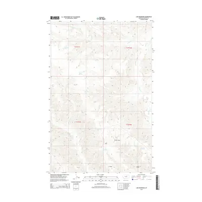
2014 Map of Lake Reservoir
USGS Topo · Published 2014About this map
High-plains water management and drainage define this section of Phillips County, where a network of catchment basins like Lake Reservoir and Monster Reservoir dot the landscape. The terrain is deeply etched by a system of coulees and creeks, most notably Beauchamp Cr and Cline Cr, which draw water through the arid cattle country of north-central Montana. The presence of Garden Coulee and the prominent C K Ridge suggests a complex topography of ridges and draws that historically dictated the movement of livestock and the placement of remote ranching outposts.
Find a feature on this map
18 named features on this map. Tap any name to fly to it.
Don’t see what you’re looking for? This feature index may not catch every label — zoom into the map to look around manually.
Map Details
Editions of this 2014 Lake Reservoir Map
This is the sole edition of this map. No revisions or reprints were ever made.
Other maps of this area

1954 · Lewistown
USGS Topo · 1:250,000

1959 · Lewistown
USGS Topo · 1:250,000

1965 · Karsten Coulee
USGS Topo · 1:24,000

1965 · Dry Coulee
USGS Topo · 1:24,000

1965 · Chain Buttes
USGS Topo · 1:24,000

1965 · Dry Fork Ridge
USGS Topo · 1:24,000
1965 · Barber Coulee
USGS Topo · 1:24,000

1965 · Lake Reservoir
USGS Topo · 1:24,000

1971 · Bison Bone Reservoir
USGS Topo · 1:24,000

1971 · Blizzard Reservoir
USGS Topo · 1:24,000