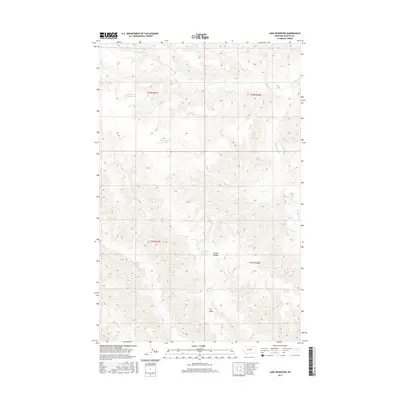
2017 Map of Lake Reservoir
USGS Topo · Published 2017About this map
Water management in Phillips County's semiarid rangeland is the central theme of this landscape, dominated by a network of catchments and drainage basins. The namesake Lake Reservoir sits near the center of the sheet, part of a series of vital water sources including Monster Reservoir, Badger Reservoir, and Dan Reservoir. These features, along with the Wildlife Reservoir and Buckskin Reservoir to the southeast, suggest a terrain primarily utilized for livestock grazing or wildlife conservation, where man-made infrastructure is essential for sustaining the local environment.
Find a feature on this map
18 named features on this map. Tap any name to fly to it.
Don’t see what you’re looking for? This feature index may not catch every label — zoom into the map to look around manually.
Map Details
Editions of this 2017 Lake Reservoir Map
This is the sole edition of this map. No revisions or reprints were ever made.
Other maps of this area

1954 · Lewistown
USGS Topo · 1:250,000

1959 · Lewistown
USGS Topo · 1:250,000

1965 · Karsten Coulee
USGS Topo · 1:24,000

1965 · Dry Coulee
USGS Topo · 1:24,000

1965 · Chain Buttes
USGS Topo · 1:24,000

1965 · Dry Fork Ridge
USGS Topo · 1:24,000
1965 · Barber Coulee
USGS Topo · 1:24,000

1965 · Lake Reservoir
USGS Topo · 1:24,000

1971 · Bison Bone Reservoir
USGS Topo · 1:24,000

1971 · Blizzard Reservoir
USGS Topo · 1:24,000