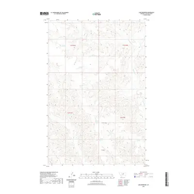
2020 Map of Lake Reservoir
USGS Topo · Published 2020About this map
Water management and drainage patterns define this portion of Phillips County, where a series of small, named catchments reflect the requirements of life and livestock in the Missouri River breaks region. The landscape is characterized by intricate drainages such as Beauchamp Cr and Cline Cr that cut through the high ground of C K Ridge. These natural waterways are supplemented by numerous small reservoirs, including Lake Reservoir, Monster Reservoir, and Badger Reservoir, which appear as vital points of interest for land use in this arid environment. The map provides a contemporary view of these features within the Public Land Survey System framework of Townships 22 and 23 North, illustrating how geographical features like Garden Coulee and Dry Fork Cr dictated the placement of small-scale infrastructure like Wildlife Reservoir and Buckskin Reservoir.
Find a feature on this map
18 named features on this map. Tap any name to fly to it.
Don’t see what you’re looking for? This feature index may not catch every label — zoom into the map to look around manually.
Map Details
Editions of this 2020 Lake Reservoir Map
This is the sole edition of this map. No revisions or reprints were ever made.
Other maps of this area

1954 · Lewistown
USGS Topo · 1:250,000

1959 · Lewistown
USGS Topo · 1:250,000

1965 · Karsten Coulee
USGS Topo · 1:24,000

1965 · Dry Coulee
USGS Topo · 1:24,000

1965 · Chain Buttes
USGS Topo · 1:24,000

1965 · Dry Fork Ridge
USGS Topo · 1:24,000
1965 · Barber Coulee
USGS Topo · 1:24,000

1965 · Lake Reservoir
USGS Topo · 1:24,000

1971 · Bison Bone Reservoir
USGS Topo · 1:24,000

1971 · Blizzard Reservoir
USGS Topo · 1:24,000