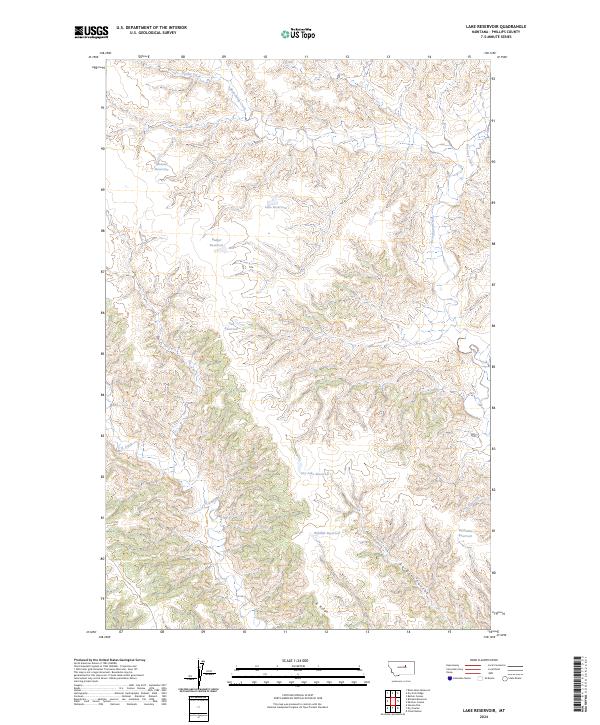
2024 Map of Lake Reservoir
USGS Topo · Published 2024About this map
The Charles M Russell National Wildlife Refuge dominates the southern half of this landscape, preserving a vast expanse of breaks and drainage systems in Phillips County. The terrain is defined by a dense network of coulees and ridges, including the prominent C K Ridge and the winding Garden Coulee. Water management is the defining human imprint on this arid environment, evidenced by a series of strategically placed catchments such as Monster Reservoir, Badger Reservoir, and Wildlife Reservoir. These features, alongside creek systems like Beauchamp Creek and Cline Creek, illustrate the complex hydrology required to sustain life and wildlife in this portion of the Montana plains. The map provides a clear view of the township and range divisions, marking the boundaries of t23n r27e and t22n r28e across the rugged breaks.
Find a feature on this map
19 named features on this map. Tap any name to fly to it.
Don’t see what you’re looking for? This feature index may not catch every label — zoom into the map to look around manually.
Map Details
Editions of this 2024 Lake Reservoir Map
This is the sole edition of this map. No revisions or reprints were ever made.
Other maps of this area

1954 · Lewistown
USGS Topo · 1:250,000

1959 · Lewistown
USGS Topo · 1:250,000

1965 · Karsten Coulee
USGS Topo · 1:24,000

1965 · Dry Coulee
USGS Topo · 1:24,000

1965 · Chain Buttes
USGS Topo · 1:24,000

1965 · Dry Fork Ridge
USGS Topo · 1:24,000
1965 · Barber Coulee
USGS Topo · 1:24,000

1965 · Lake Reservoir
USGS Topo · 1:24,000

1971 · Bison Bone Reservoir
USGS Topo · 1:24,000

1971 · Blizzard Reservoir
USGS Topo · 1:24,000