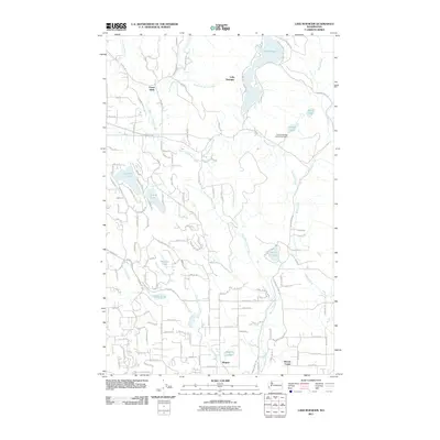
2011 Map of Lake Roesiger
USGS Topo · Published 2011About this map
Lake Roesiger serves as the central focal point for this Snohomish County landscape, where the irregular shoreline and surrounding road networks like N Lake Roesiger Rd and SW Lake Roesiger Rd suggest a well-established recreational and residential corridor. To the south and west, a dense network of smaller water bodies including Flowing Lake, Storm Lake, Meadow Lake, and Chain Lake indicates a glaciated terrain defined by its complex hydrology. The presence of the Chief Seattle Boy Scout Reservation near Hughes Lake and Bevis Lake highlights the area's significance for youth outdoor education and conservation. Small community centers such as Forest Glade and Wagner are connected by a grid of residential and utility roads, including Pipeline Rd, while the drainage of West Fork Woods Creek and Richardson Creek shapes the lower valleys near the settlement of Woods Creek.
Find a feature on this map
51 named features on this map. Tap any name to fly to it.
Don’t see what you’re looking for? This feature index may not catch every label — zoom into the map to look around manually.
Map Details
Editions of this 2011 Lake Roesiger Map
This is the sole edition of this map. No revisions or reprints were ever made.
Other maps of this area

1895 · Snohomish
USGS Topo · 1:125,000

1897 · Seattle
USGS Topo · 1:125,000

1899 · Stillaguamish
USGS Topo · 1:125,000

1901 · Stilaguamish
USGS Topo · 1:125,000

1911 · Mount Vernon
USGS Topo · 1:125,000

1921 · Sultan
USGS Topo · 1:125,000

1923 · Sultan
USGS Topo · 1:125,000

1941 · Marysville
USGS Topo · 1:62,500

1943 · Marysville
USGS Topo · 1:62,500

1944 · Everett
USGS Topo · 1:62,500