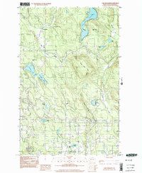
1997 Map of Lake Roesiger
USGS Topo · Published 2003About this map
Lake Roesiger and its surrounding timbered uplands define this portion of Snohomish County during the late twentieth century. The map reveals a landscape primarily shaped by recreation and resource management, anchored by large water bodies such as Flowing Lake, Storm Lake, and Chain Lake. Settlement is concentrated in small pockets like Forest Glade and Wagner, while the terrain is dominated by the prominent Three Lakes Hill. The infrastructure of the era is clearly visible through a network of transmission lines and a pipeline cutting across the southern sections, contrasting with the public access points at Lake Roesiger Park and Flowing Lake Park. Small-scale industrial activity is evidenced by a Gravel Pit near the headwaters of Dubuque Creek, showing the ongoing utility of the land alongside its residential and parkland developments.
Find a feature on this map
29 named features on this map. Tap any name to fly to it.
Don’t see what you’re looking for? This feature index may not catch every label — zoom into the map to look around manually.
Map Details
Editions of this 1997 Lake Roesiger Map
This is the sole edition of this map. No revisions or reprints were ever made.
Other maps of this area

1895 · Snohomish
USGS Topo · 1:125,000

1897 · Seattle
USGS Topo · 1:125,000

1899 · Stillaguamish
USGS Topo · 1:125,000

1901 · Stilaguamish
USGS Topo · 1:125,000

1911 · Mount Vernon
USGS Topo · 1:125,000

1921 · Sultan
USGS Topo · 1:125,000

1923 · Sultan
USGS Topo · 1:125,000

1941 · Marysville
USGS Topo · 1:62,500

1943 · Marysville
USGS Topo · 1:62,500

1944 · Everett
USGS Topo · 1:62,500