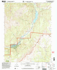
2001 Map of Lake San Cristobal
USGS Topo · Published 2005About this map
Lake San Cristobal dominates this high-altitude landscape in Hinsdale County, where the massive Slumgullion Slide historically dammed the Lake Fork Gunnison River to create Colorado's second-largest natural lake. This 2001 revision illustrates a complex geography of alpine resource extraction and recreation, showing numerous Mines and a Gravel Pit alongside the designated Scenic Trail. The map details the boundary between the Gunnison National Forest and the Rio Grande National Forest, with the Continental Divide serving as a prominent topographic spine. Local genealogy and land use are marked by a small Cem and Williams Creek settlement features, while a remote Landing Strip near Castle Lakes points to the specialized transport needs of this isolated mountain terrain.
Find a feature on this map
35 named features on this map. Tap any name to fly to it.
Don’t see what you’re looking for? This feature index may not catch every label — zoom into the map to look around manually.
Map Details
Editions of this 2001 Lake San Cristobal Map
This is the sole edition of this map. No revisions or reprints were ever made.
Other maps of this area

1903 · Lake City
USGS Topo · 1:62,500

1905 · Lake City
USGS Topo · 1:62,500

1905 · San Cristobal
USGS Topo · 1:125,000

1907 · San Cristobal
USGS Topo · 1:125,000

1908 · Uncompahgre
USGS Topo · 1:125,000

1911 · Uncompahgre
USGS Topo · 1:125,000

1945 · Durango
USGS Topo · 1:250,000

1953 · Durango
USGS Topo · 1:250,000

1954 · Durango
USGS Topo · 1:250,000

1956 · Montrose
USGS Topo · 1:250,000