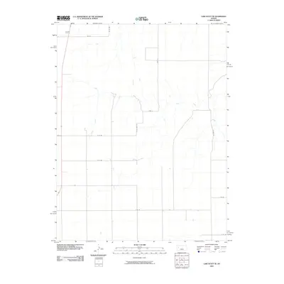
2009 Map of Lake Scott NE
USGS Topo · Published 2009About this map
Keystone Cemetery stands as a quiet landmark in the northwestern corner of this Logan County landscape, situated along the road labeled Dakota. The area is defined by a sparse but organized grid of rural roads, including Co Rd 450 and Gove 12, which partition the high plains terrain. Significant natural drainage is provided by the winding course of Hell Creek, which snakes through the central and eastern portions of the map. The road network, featuring names like N Oliviera Rd and N Taos Rd, reflects the agricultural layout of the region in the early twenty-first century. This map offers a clear view of the section lines and rural infrastructure typical of the western Kansas plains before further modern development, providing a stable reference for local land use and genealogical research.
Find a feature on this map
13 named features on this map. Tap any name to fly to it.
Don’t see what you’re looking for? This feature index may not catch every label — zoom into the map to look around manually.
Map Details
Editions of this 2009 Lake Scott NE Map
This is the sole edition of this map. No revisions or reprints were ever made.
Other maps of this area

1939 · Lake Mc Bride
USGS Topo · 1:24,000

1939 · Sandon
USGS Topo · 1:62,500

1942 · Sandon
USGS Topo · 1:62,500

1942 · Lake Mc Bride
USGS Topo · 1:31,680

1955 · Scott City
USGS Topo · 1:250,000

1958 · Scott City
USGS Topo · 1:250,000

1974 · Healy NW
USGS Topo · 1:24,000

1974 · Elkader SW
USGS Topo · 1:24,000

1974 · Elkader
USGS Topo · 1:24,000

1974 · Manning
USGS Topo · 1:24,000