
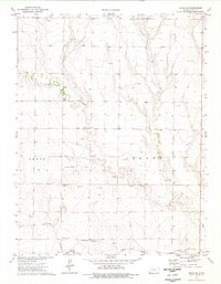
1974 Map of Healy NW
USGS Topo · Published 1976About this map
The Smoky Hill River flows through the northern reaches of this High Plains landscape, where the drainage systems of Hell Creek and the various forks of West Salt Creek and East Salt Creek carve into the terrain. This 1974 survey captures a moment when the rural character of western Kansas was defined by large-scale agricultural townships and intermittent mineral extraction. The map reveals the industrial footprint of the era through several Caliche Pits and a Sandpit, points of interest for local historians studying the region's road-building and construction resources. Spanning the intersection of several administrative areas, the sheet documents the convergence of the Lewis, Michigan, and Cheyenne districts, marking the precise boundary where Gove, Scott, and Lane Counties meet.
Find a feature on this map
13 named features on this map. Tap any name to fly to it.
Don’t see what you’re looking for? This feature index may not catch every label — zoom into the map to look around manually.
Map Details
Editions of this 1974 Healy NW Map
This is the sole edition of this map. No revisions or reprints were ever made.
Other maps of this area

1939 · Sandon
USGS Topo · 1:62,500

1942 · Sandon
USGS Topo · 1:62,500

1955 · Scott City
USGS Topo · 1:250,000

1958 · Scott City
USGS Topo · 1:250,000

1974 · Cheyenne Creek
USGS Topo · 1:24,000
1974 · Orion SE
USGS Topo · 1:24,000

1974 · Elkader
USGS Topo · 1:24,000

1974 · Manning
USGS Topo · 1:24,000

1974 · Healy
USGS Topo · 1:24,000
1974 · Orion SW
USGS Topo · 1:24,000