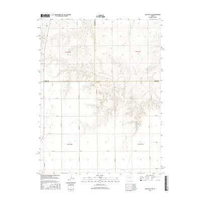
2015 Map of Lake Scott NE
USGS Topo · Published 2015About this map
Keystone Cem stands as a solitary historical marker in the northwestern corner of this High Plains landscape, situated just north of Bison Rd. This area, where Logan, Gove, and Scott counties meet, is defined by the sharp transition from the flat upland plateau into the deeply dissected drainages of Hell Cr and W Salt Cr. The map reveals a complex network of canyons and draws that break the prairie surface, particularly around the area labeled Dakota. A cluster of hydrological activity is visible at Big Springs, highlighting the importance of groundwater in this semi-arid region. The township and range lines of t15s r32w and t16s r31w provide a rigid geometric contrast to the winding natural contours of the breaks, illustrating the intersection of the Public Land Survey System with a challenging physical geography.
Find a feature on this map
31 named features on this map. Tap any name to fly to it.
Don’t see what you’re looking for? This feature index may not catch every label — zoom into the map to look around manually.
Map Details
Editions of this 2015 Lake Scott NE Map
This is the sole edition of this map. No revisions or reprints were ever made.
Other maps of this area

1939 · Lake Mc Bride
USGS Topo · 1:24,000

1939 · Sandon
USGS Topo · 1:62,500

1942 · Sandon
USGS Topo · 1:62,500

1942 · Lake Mc Bride
USGS Topo · 1:31,680

1955 · Scott City
USGS Topo · 1:250,000

1958 · Scott City
USGS Topo · 1:250,000

1974 · Healy NW
USGS Topo · 1:24,000

1974 · Elkader SW
USGS Topo · 1:24,000

1974 · Elkader
USGS Topo · 1:24,000

1974 · Manning
USGS Topo · 1:24,000