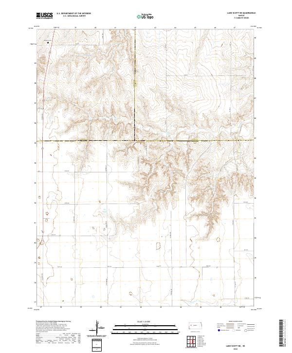
2022 Map of Lake Scott NE
USGS Topo · Published 2022About this map
Keystone Cem stands near the northern boundary of this Western Kansas landscape, marking a point of rest in the High Plains where Logan, Gove, and Scott counties meet. The terrain is defined by the drainage systems of Hell Cr and W Salt Cr, which carve through the Dakota uplands. This survey illustrates a strictly organized section-line road network, where routes like Bison Rd and Gove A navigate the natural contours of the draws and breaks. The presence of Big Springs highlights a vital water source in this semi-arid environment, a critical landmark for early settlement and local agriculture. The transition between Logan and Scott counties is meticulously detailed, showing how the rural infrastructure of the 21st century remains anchored to the original Public Land Survey System grids established over a century ago.
Find a feature on this map
31 named features on this map. Tap any name to fly to it.
Don’t see what you’re looking for? This feature index may not catch every label — zoom into the map to look around manually.
Map Details
Editions of this 2022 Lake Scott NE Map
This is the sole edition of this map. No revisions or reprints were ever made.
Other maps of this area

1939 · Lake Mc Bride
USGS Topo · 1:24,000

1939 · Sandon
USGS Topo · 1:62,500

1942 · Sandon
USGS Topo · 1:62,500

1942 · Lake Mc Bride
USGS Topo · 1:31,680

1955 · Scott City
USGS Topo · 1:250,000

1958 · Scott City
USGS Topo · 1:250,000

1974 · Healy NW
USGS Topo · 1:24,000

1974 · Elkader SW
USGS Topo · 1:24,000

1974 · Elkader
USGS Topo · 1:24,000

1974 · Manning
USGS Topo · 1:24,000