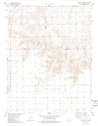
1976 Map of Lake Scott NE
USGS Topo · Published 1978About this map
Keystone Cem stands near the northern boundary of this High Plains landscape, marking the rural heritage of a region defined by its wide, open drainages and early energy exploration. The topography is dominated by the winding path of Hell Creek, which carves through the central portion of the quadrangle between the areas of Lees and Lewis. This 1970s survey captures the agricultural and industrial transition of western Kansas, where traditional farmsteads like Ryan exist alongside a growing network of resources, indicated by several scattered Wells and a specific Oil Well in the south. The intersection of Logan and Scott counties meets the Gove and Scott county lines here, centering on the township of Michigan. The inclusion of fine red dashed lines to represent fence and field lines provides an exceptionally detailed look at land division and property boundaries during this era.
Find a feature on this map
12 named features on this map. Tap any name to fly to it.
Don’t see what you’re looking for? This feature index may not catch every label — zoom into the map to look around manually.
Map Details
Editions of this 1976 Lake Scott NE Map
This is the sole edition of this map. No revisions or reprints were ever made.
Other maps of this area

1939 · Lake Mc Bride
USGS Topo · 1:24,000

1939 · Sandon
USGS Topo · 1:62,500

1942 · Sandon
USGS Topo · 1:62,500

1942 · Lake Mc Bride
USGS Topo · 1:31,680

1955 · Scott City
USGS Topo · 1:250,000

1958 · Scott City
USGS Topo · 1:250,000

1974 · Healy NW
USGS Topo · 1:24,000

1974 · Elkader SW
USGS Topo · 1:24,000

1974 · Elkader
USGS Topo · 1:24,000

1974 · Manning
USGS Topo · 1:24,000