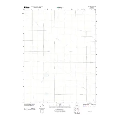
2010 Map of Lake SE
USGS Topo · Published 2010About this map
Long Branch meanders across this rural section of Lincoln County, defining the primary drainage pattern of the high plains landscape. The area is characterized by a precise rectilinear grid of section lines and gravel roads, reflecting the systematic land division of the American West. This 2010 survey by the U.S. Geological Survey details the intersection of several local routes, including County RD-25 and County RD-2R, which facilitate movement across this sparsely populated agricultural or ranching territory. Smaller ephemeral water bodies and depressions are scattered throughout the quadrangle, illustrating the subtle hydrology of the region and how local infrastructure like County RD-27 navigates the winding course of the creek.
Find a feature on this map
12 named features on this map. Tap any name to fly to it.
Don’t see what you’re looking for? This feature index may not catch every label — zoom into the map to look around manually.
Map Details
Editions of this 2010 Lake SE Map
This is the sole edition of this map. No revisions or reprints were ever made.
Other maps of this area

1889 · Sanborn
USGS Topo · 1:125,000

1891 · Sanborn
USGS Topo · 1:125,000

1891 · Arroyo
USGS Topo · 1:125,000

1891 · Limon
USGS Topo · 1:125,000

1892 · Limon
USGS Topo · 1:125,000

1893 · Arroyo
USGS Topo · 1:125,000

1893 · Sanborn
USGS Topo · 1:125,000

1954 · Limon
USGS Topo · 1:250,000

1954 · Lamar
USGS Topo · 1:250,000

1957 · Limon
USGS Topo · 1:250,000