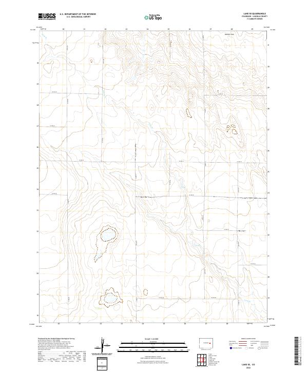
2022 Map of Lake SE
USGS Topo · Published 2022About this map
Webber Park and the intermittent drainage of Long Br define the high plains landscape of Lincoln County in this recent survey. The terrain is organized by a sparse but regular grid of section roads including Co Rd 25 and Co Rd 27, reflecting the enduring Public Land Survey System structure that has shaped Colorado's eastern agricultural and ranching lands for generations. Aside from the occasional water catchment and the meandering path of the branch, the area remains open and largely undeveloped. Researchers can use the township and range designations, such as t11s r55w and t12s r56w, to precisely locate specific land parcels or historical homestead sites within this expansive prairie environment.
Find a feature on this map
18 named features on this map. Tap any name to fly to it.
Don’t see what you’re looking for? This feature index may not catch every label — zoom into the map to look around manually.
Map Details
Editions of this 2022 Lake SE Map
This is the sole edition of this map. No revisions or reprints were ever made.
Other maps of this area

1889 · Sanborn
USGS Topo · 1:125,000

1891 · Sanborn
USGS Topo · 1:125,000

1891 · Arroyo
USGS Topo · 1:125,000

1891 · Limon
USGS Topo · 1:125,000

1892 · Limon
USGS Topo · 1:125,000

1893 · Arroyo
USGS Topo · 1:125,000

1893 · Sanborn
USGS Topo · 1:125,000

1954 · Limon
USGS Topo · 1:250,000

1954 · Lamar
USGS Topo · 1:250,000

1957 · Limon
USGS Topo · 1:250,000