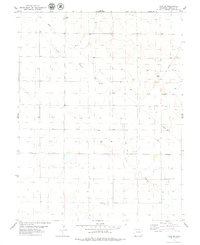
1979 Map of Lake SE
USGS Topo · Published 1979About this map
The arid high plains of eastern Colorado are defined by subtle drainage patterns and sparse infrastructure in the late 1970s. The seasonal path of Long Branch provides the primary topographic orientation for this Lincoln County landscape, meandering through a series of sections largely devoted to open rangeland and intermittent water resources. Isolated agricultural and utility developments appear in the form of multiple Well sites and several Tank structures, reflecting the importance of water management in this environment. A lone Radio Tower stands as a rare vertical landmark in an area otherwise characterized by low-relief terrain and a grid of unimproved roads and fence lines, documenting the rural character and essential service points of the region during this era.
Find a feature on this map
4 named features on this map. Tap any name to fly to it.
Don’t see what you’re looking for? This feature index may not catch every label — zoom into the map to look around manually.
Map Details
Editions of this 1979 Lake SE Map
This is the sole edition of this map. No revisions or reprints were ever made.
Other maps of this area

1889 · Sanborn
USGS Topo · 1:125,000

1891 · Sanborn
USGS Topo · 1:125,000

1891 · Arroyo
USGS Topo · 1:125,000

1891 · Limon
USGS Topo · 1:125,000

1892 · Limon
USGS Topo · 1:125,000

1893 · Arroyo
USGS Topo · 1:125,000

1893 · Sanborn
USGS Topo · 1:125,000

1954 · Limon
USGS Topo · 1:250,000

1954 · Lamar
USGS Topo · 1:250,000

1957 · Limon
USGS Topo · 1:250,000