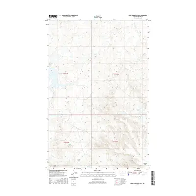
2017 Map of Lake Seventeen East
USGS Topo · Published 2017About this map
Spirit Woman Butte and Timber Ridge define the elevation in this corner of the Hays District within Blaine County. This 2017 survey documents a landscape dominated by intermittent drainages and isolated water bodies, reflecting the hydrologic patterns of the Montana plains. The topography is shaped by features such as Warneke Coulee, which cuts through the southern reaches near Warneke Flat, and the namesake Lake Seventeen in the northwest. Several small creeks, including Duck Cr, Little Peoples Cr, and Little Suction Cr, navigate the subtle shifts in terrain, while Skinners Lake sits in a shallow depression to the east. The map provides a precise look at the township and range system, showing the boundaries of T27N and T26N across the R22E and R23E lines.
Find a feature on this map
14 named features on this map. Tap any name to fly to it.
Don’t see what you’re looking for? This feature index may not catch every label — zoom into the map to look around manually.
Map Details
Editions of this 2017 Lake Seventeen East Map
This is the sole edition of this map. No revisions or reprints were ever made.
Other maps of this area

1943 · Landusky
USGS Topo · 1:125,000

1953 · Havre
USGS Topo · 1:250,000

1954 · Lewistown
USGS Topo · 1:250,000

1957 · Havre
USGS Topo · 1:250,000

1958 · Havre
USGS Topo · 1:250,000

1959 · Lewistown
USGS Topo · 1:250,000

1971 · Crazyman Coulee
USGS Topo · 1:24,000

1971 · Putnam Lake
USGS Topo · 1:24,000

1971 · Hays
USGS Topo · 1:24,000

1971 · Lodge Pole NW
USGS Topo · 1:24,000