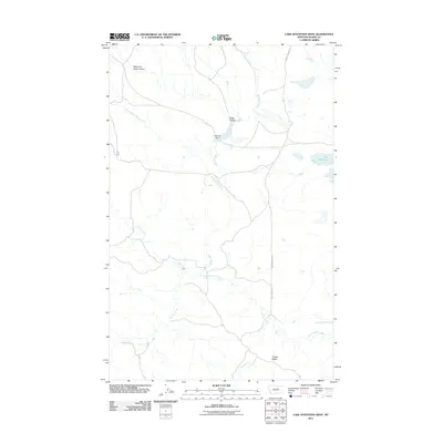
2011 Map of Lake Seventeen West
USGS Topo · Published 2011About this map
Lake Seventeen anchors the high plains of Blaine County in this survey of a landscape defined by seasonal drainages and cattle country. The hydrology of the region is centered on Mitchell Dam and a series of winding coulees, including Jacks Coulee and Tin Cup Coulee, which channel water toward the larger Rattlesnake Creek. These intermittent streams dictate the movement of roads like Barney Olson Rd, which skirts the northern section-lines. To the south, the topography rises toward Timber Ridge, a prominent landform that provides a vantage over the network of tributaries such as Suction Creek and Little Suction Creek. The map documents a period of modern ranching infrastructure where named roads and water management features represent the primary human imprint on the northern Montana prairie.
Find a feature on this map
11 named features on this map. Tap any name to fly to it.
Don’t see what you’re looking for? This feature index may not catch every label — zoom into the map to look around manually.
Map Details
Editions of this 2011 Lake Seventeen West Map
This is the sole edition of this map. No revisions or reprints were ever made.
Other maps of this area

1943 · Landusky
USGS Topo · 1:125,000

1953 · Havre
USGS Topo · 1:250,000

1954 · Lewistown
USGS Topo · 1:250,000

1956 · Rattlesnake
USGS Topo · 1:62,500

1957 · Havre
USGS Topo · 1:250,000

1958 · Havre
USGS Topo · 1:250,000

1959 · Lewistown
USGS Topo · 1:250,000

1971 · Crazyman Coulee
USGS Topo · 1:24,000

1971 · Putnam Lake
USGS Topo · 1:24,000
1971 · Lake Seventeen NE
USGS Topo · 1:24,000