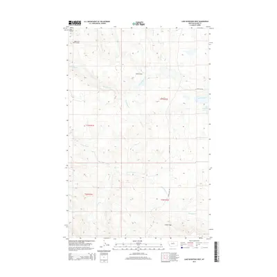
2014 Map of Lake Seventeen West
USGS Topo · Published 2014About this map
Lake Seventeen serves as a central landmark in this remote corner of Blaine County, where the high plains transition into more complex drainage patterns. The landscape is defined by the significant branching of Jacks Coulee and West Fork Jacks Coulee in the northwest, while the southern reaches are dominated by the elevation of Timber Ridge. This 2014 survey documents a territory shaped by intermittent watercourses like Rattlesnake Cr and Tin Cup Coulee, which carve through the terrain before feeding into the larger systems of Suction Creek and its tributary, Little Suction Cr. Human presence is sparse, marked primarily by rural arteries such as Barney Olson Rd and Duck Creek Rd, illustrating the vast, open character of the Montana ranchlands during this era.
Find a feature on this map
15 named features on this map. Tap any name to fly to it.
Don’t see what you’re looking for? This feature index may not catch every label — zoom into the map to look around manually.
Map Details
Editions of this 2014 Lake Seventeen West Map
This is the sole edition of this map. No revisions or reprints were ever made.
Other maps of this area

1943 · Landusky
USGS Topo · 1:125,000

1953 · Havre
USGS Topo · 1:250,000

1954 · Lewistown
USGS Topo · 1:250,000

1956 · Rattlesnake
USGS Topo · 1:62,500

1957 · Havre
USGS Topo · 1:250,000

1958 · Havre
USGS Topo · 1:250,000

1959 · Lewistown
USGS Topo · 1:250,000

1971 · Crazyman Coulee
USGS Topo · 1:24,000

1971 · Putnam Lake
USGS Topo · 1:24,000
1971 · Lake Seventeen NE
USGS Topo · 1:24,000