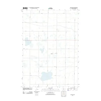
2012 Map of Lake Sinai
USGS Topo · Published 2012About this map
Lake Sinai and Brush Lake dominate the landscape of this Brookings County quadrangle, reflecting a glaciated terrain defined by numerous sloughs and seasonal basins. This 2012 survey by the U.S. Geological Survey captures the rural character of the region just before modern agricultural and infrastructure shifts. The tiny settlement of Ahnberg serves as a local landmark amidst a rigid grid of section roads, including 457th Ave and 212th St. For those researching local history or genealogy, the presence of Bangor Cem near the western edge of the map provides a specific point of interest for tracing early family roots in the township. The area is intersected by Route 14, which serves as the primary east-west artery through this prairie landscape.
Find a feature on this map
20 named features on this map. Tap any name to fly to it.
Don’t see what you’re looking for? This feature index may not catch every label — zoom into the map to look around manually.
Map Details
Editions of this 2012 Lake Sinai Map
This is the sole edition of this map. No revisions or reprints were ever made.
Other maps of this area

1953 · Watertown
USGS Topo · 1:250,000

1958 · Watertown
USGS Topo · 1:250,000

1968 · Lake Sinai
USGS Topo · 1:24,000

1968 · Bruce
USGS Topo · 1:24,000

1968 · Arlington
USGS Topo · 1:24,000

1968 · Volga
USGS Topo · 1:24,000

1968 · Arlington NE
USGS Topo · 1:24,000

1968 · Sinai
USGS Topo · 1:24,000

1968 · Badger
USGS Topo · 1:24,000
1968 · Madison NW
USGS Topo · 1:24,000