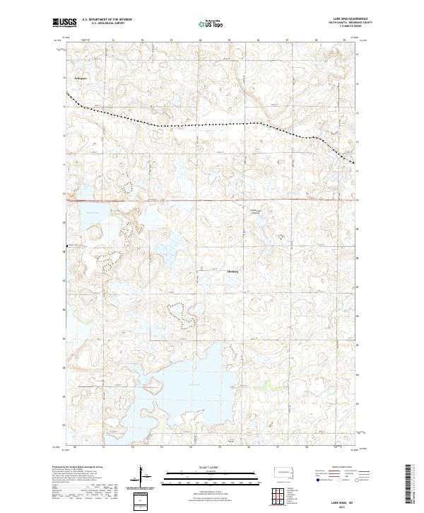
2021 Map of Lake Sinai
USGS Topo · Published 2021About this map
Lake Sinai anchors the southern portion of this landscape, situated within the distinctive glacial highlands known as the Coteau des Prairies. This plateau region in eastern South Dakota is characterized by a high concentration of prairie potholes and wetlands, evident in the numerous unnamed basins scattered across the township lines. The settlement of Arlington is positioned in the northwest corner, while the smaller locality of Ahnberg sits further south near the intersection of 212A St and Co Rd 11. Local history is preserved at Bangor Cem, located just west of Brush Lake. The map reveals a highly structured grid of section lines and county roads, such as 460th Ave, which define the agricultural divisions of Brookings County during this era of modern land management.
Find a feature on this map
30 named features on this map. Tap any name to fly to it.
Don’t see what you’re looking for? This feature index may not catch every label — zoom into the map to look around manually.
Map Details
Editions of this 2021 Lake Sinai Map
This is the sole edition of this map. No revisions or reprints were ever made.
Other maps of this area

1953 · Watertown
USGS Topo · 1:250,000

1958 · Watertown
USGS Topo · 1:250,000

1968 · Lake Sinai
USGS Topo · 1:24,000

1968 · Bruce
USGS Topo · 1:24,000

1968 · Arlington
USGS Topo · 1:24,000

1968 · Volga
USGS Topo · 1:24,000

1968 · Arlington NE
USGS Topo · 1:24,000

1968 · Sinai
USGS Topo · 1:24,000

1968 · Badger
USGS Topo · 1:24,000
1968 · Madison NW
USGS Topo · 1:24,000