
1968 Map of Lake Sinai
USGS Topo · Published 1970About this map
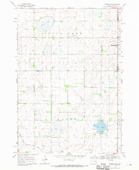
Lake Sinai dominates this prairie landscape in Brookings County, recorded by the Geological Survey during the late 1960s. The region is marked by a complex of water bodies and conservation lands, including the National Wildlife Management Area and Brush Lake. Transportation and infrastructure are central to the area's layout, with the Chicago and North Western and Great Northern railroads cutting across the northern sections of Winsor and Bangor townships.
Find a feature on this map
18 named features on this map. Tap any name to fly to it.
Don’t see what you’re looking for? This feature index may not catch every label — zoom into the map to look around manually.
Map Details
Editions of this 1968 Lake Sinai Map
This is the sole edition of this map. No revisions or reprints were ever made.
Other maps of this area

1953 · Watertown
USGS Topo · 1:250,000

1958 · Watertown
USGS Topo · 1:250,000

1968 · Bruce
USGS Topo · 1:24,000

1968 · Arlington
USGS Topo · 1:24,000

1968 · Volga
USGS Topo · 1:24,000

1968 · Arlington NE
USGS Topo · 1:24,000

1968 · Sinai
USGS Topo · 1:24,000

1968 · Badger
USGS Topo · 1:24,000
1968 · Madison NW
USGS Topo · 1:24,000
1968 · Rutland NW
USGS Topo · 1:24,000