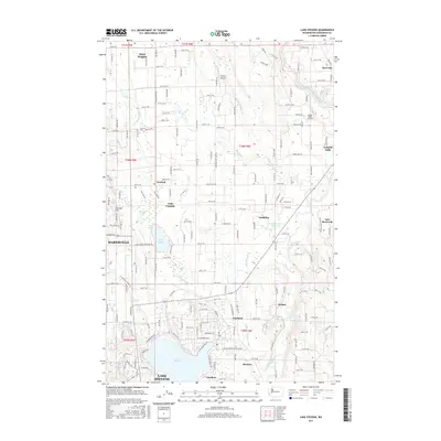
2017 Map of Lake Stevens
USGS Topo · Published 2017About this map
Lake Stevens and the surrounding Snohomish County countryside are depicted here during a period of sustained suburban transition. The landscape is defined by its complex hydrology, where the Pilchuck River and the South Fork Stillaguamish River frame a network of smaller streams like Catherine Cr and Little Pilchuck Cr. The map captures the distinct identities of unincorporated communities such as Hartford, Machias, and Getchell, while the eastern edge of Marysville begins to influence the western parcels. Local aviation is a notable feature of the area's development, evidenced by the presence of Frontier Airpark and Green Valley Airfield. Natural landmarks like Lake Cassidy and Lake Bosworth provide clear reference points for those studying the drainage patterns and historical land use between the growing city centers and the foothills of the Cascades.
Find a feature on this map
131 named features on this map. Tap any name to fly to it.
Don’t see what you’re looking for? This feature index may not catch every label — zoom into the map to look around manually.
Map Details
Editions of this 2017 Lake Stevens Map
This is the sole edition of this map. No revisions or reprints were ever made.
Other maps of this area

1895 · Snohomish
USGS Topo · 1:125,000

1897 · Seattle
USGS Topo · 1:125,000

1899 · Stillaguamish
USGS Topo · 1:125,000

1901 · Stilaguamish
USGS Topo · 1:125,000

1911 · Mount Vernon
USGS Topo · 1:125,000

1921 · Sultan
USGS Topo · 1:125,000

1923 · Sultan
USGS Topo · 1:125,000

1941 · Marysville
USGS Topo · 1:62,500

1943 · Marysville
USGS Topo · 1:62,500

1944 · Everett
USGS Topo · 1:62,500