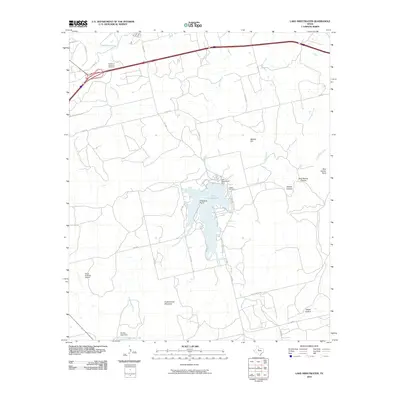
2010 Map of Lake Sweetwater
USGS Topo · Published 2010About this map
Lake Sweetwater serves as the central anchor of this landscape north of the city, where the water is contained by the Lake Sweetwater Dam and surrounded by prominent landforms like Firemans Point and Beacon Hill. The map illustrates the transition from the rolling plains of West Texas into more complex breaks and canyons, such as Outlaw Canyon and Dug Spring Canyon to the east.
Find a feature on this map
37 named features on this map. Tap any name to fly to it.
Don’t see what you’re looking for? This feature index may not catch every label — zoom into the map to look around manually.
Map Details
Editions of this 2010 Lake Sweetwater Map
This is the sole edition of this map. No revisions or reprints were ever made.
Other maps of this area

1893 · Roby
USGS Topo · 1:125,000

1893 · Sweetwater
USGS Topo · 1:125,000

1954 · Big Spring
USGS Topo · 1:250,000

1957 · Merkel
USGS Topo · 1:62,500

1957 · Noodle
USGS Topo · 1:62,500

1958 · Big Spring
USGS Topo · 1:250,000

1969 · Busby
USGS Topo · 1:24,000

1969 · Eskota
USGS Topo · 1:24,000

1969 · Sweetwater
USGS Topo · 1:24,000

1969 · Holder Creek
USGS Topo · 1:24,000