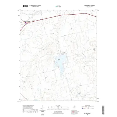
2019 Map of Lake Sweetwater
USGS Topo · Published 2019About this map
Sweetwater anchors the northwestern corner of this landscape, where Interstate 20 and the Texas and Pacific Railway corridor have long shaped the region's movement. The terrain here is defined by the breaks and canyons of the Rolling Plains, most notably where Lake Sweetwater was impounded among the limestone bluffs. This 2019 survey documents the complex topography surrounding the reservoir, including named heights like Beacon Hill and Cottonwood Mtn, alongside distinct relief features such as Outlaw Canyon and Dug Spring Canyon. For genealogists, the map identifies local burial grounds including the Garden of Memories Cem near the city and the more remote Coffee Cem to the east. The map also captures the rural infrastructure of Nolan County, featuring private airstrips like Gesin Ranches Airport and Rafter P Airport that serve the ranching operations situated between Bitter Cr and Sweetwater Cr.
Find a feature on this map
44 named features on this map. Tap any name to fly to it.
Don’t see what you’re looking for? This feature index may not catch every label — zoom into the map to look around manually.
Map Details
Editions of this 2019 Lake Sweetwater Map
This is the sole edition of this map. No revisions or reprints were ever made.
Other maps of this area

1893 · Roby
USGS Topo · 1:125,000

1893 · Sweetwater
USGS Topo · 1:125,000

1954 · Big Spring
USGS Topo · 1:250,000

1957 · Merkel
USGS Topo · 1:62,500

1957 · Noodle
USGS Topo · 1:62,500

1958 · Big Spring
USGS Topo · 1:250,000

1969 · Busby
USGS Topo · 1:24,000

1969 · Eskota
USGS Topo · 1:24,000

1969 · Sweetwater
USGS Topo · 1:24,000

1969 · Holder Creek
USGS Topo · 1:24,000