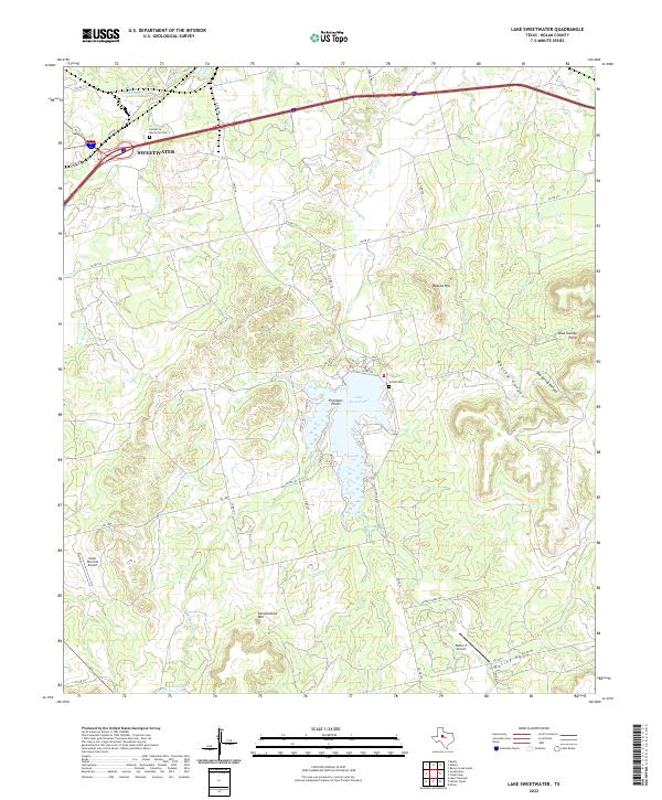
2022 Map of Lake Sweetwater
USGS Topo · Published 2022About this map
Lake Sweetwater serves as the focal point of this Central Texas landscape, its jagged shoreline defined by Firemans Point and several winding inlets. The surrounding terrain is deeply incised by canyons and hollows, including Outlaw Canyon, Dug Spring Canyon, and Oaties Hollow. These geographic features suggest a land of significant elevation changes, further evidenced by landmarks such as Cottonwood Mtn, Beacon Hill, and the descriptively named Blue Gainey Point.
Find a feature on this map
47 named features on this map. Tap any name to fly to it.
Don’t see what you’re looking for? This feature index may not catch every label — zoom into the map to look around manually.
Map Details
Editions of this 2022 Lake Sweetwater Map
This is the sole edition of this map. No revisions or reprints were ever made.
Other maps of this area

1893 · Roby
USGS Topo · 1:125,000

1893 · Sweetwater
USGS Topo · 1:125,000

1954 · Big Spring
USGS Topo · 1:250,000

1957 · Merkel
USGS Topo · 1:62,500

1957 · Noodle
USGS Topo · 1:62,500

1958 · Big Spring
USGS Topo · 1:250,000

1969 · Busby
USGS Topo · 1:24,000

1969 · Eskota
USGS Topo · 1:24,000

1969 · Sweetwater
USGS Topo · 1:24,000

1969 · Holder Creek
USGS Topo · 1:24,000