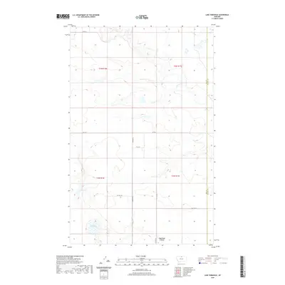
2020 Map of Lake Thibadeau
USGS Topo · Published 2020About this map
Lake Thibadeau dominates the southern landscape of this Hill County survey, situated just north of the East End Colony. This region of Montana, defined by its agricultural layout and water management, features a significant water Diversion system designed to harness the flow of Lodge Creek as it winds through the eastern townships. The map illustrates a meticulously organized grid of section lines and local thoroughfares, including Shepherd Rd and Rd 170 N, which provide access to the vast tracts of farmland and private rangeland. The boundary between Hill and Blaine counties is clearly marked along the eastern edge, showing how these political divisions intersect with the natural drainage patterns of the high plains. Researchers will find a clear record of modern land use, from the named private crop roads to the distinct settlement pattern of the Hutterite colony.
Find a feature on this map
15 named features on this map. Tap any name to fly to it.
Don’t see what you’re looking for? This feature index may not catch every label — zoom into the map to look around manually.
Map Details
Editions of this 2020 Lake Thibadeau Map
This is the sole edition of this map. No revisions or reprints were ever made.
Other maps of this area

1904 · Yantic
USGS Topo · 1:62,500

1904 · Havre
USGS Topo · 1:62,500

1912 · Zurich
USGS Topo · 1:125,000

1912 · Thibedeau Lake
USGS Topo · 1:125,000

1953 · Havre
USGS Topo · 1:250,000

1957 · Havre
USGS Topo · 1:250,000

1958 · Havre
USGS Topo · 1:250,000

1964 · Havre NW
USGS Topo · 1:24,000
1964 · Reservoir Coulee
USGS Topo · 1:24,000
1964 · Havre NE
USGS Topo · 1:24,000