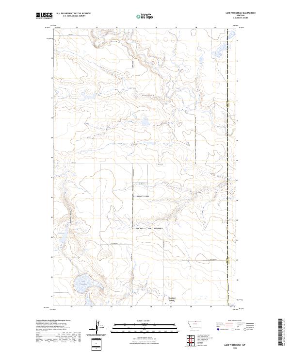
2024 Map of Lake Thibadeau
USGS Topo · Published 2024About this map
Lake Thibadeau National Wildlife Refuge anchors this section of the northern Montana plains, preserving a critical wetland habitat where the prairie meets the water. The landscape is defined by the winding course of Lodge Creek and the drainage of Lohman Coulee, which feed into the central basin of Lake Thibadeau. Human activity in this rural expanse is marked by the presence of the East End Colony in the southeastern corner, along with a network of local routes like Shepherd Rd and Rd 170 N. A hydraulic Diversion located near the coulee suggests managed water resources in an environment where moisture is vital. The eastern edge of the map follows the straight-line boundary of the Hill Co Blaine Co line, illustrating the intersection of natural drainage patterns with formal geopolitical divisions in the Big Sky Country.
Find a feature on this map
16 named features on this map. Tap any name to fly to it.
Don’t see what you’re looking for? This feature index may not catch every label — zoom into the map to look around manually.
Map Details
Editions of this 2024 Lake Thibadeau Map
This is the sole edition of this map. No revisions or reprints were ever made.
Other maps of this area

1904 · Yantic
USGS Topo · 1:62,500

1904 · Havre
USGS Topo · 1:62,500

1912 · Zurich
USGS Topo · 1:125,000

1912 · Thibedeau Lake
USGS Topo · 1:125,000

1953 · Havre
USGS Topo · 1:250,000

1957 · Havre
USGS Topo · 1:250,000

1958 · Havre
USGS Topo · 1:250,000

1964 · Havre NW
USGS Topo · 1:24,000
1964 · Reservoir Coulee
USGS Topo · 1:24,000
1964 · Havre NE
USGS Topo · 1:24,000