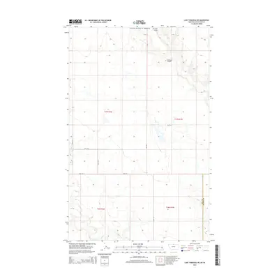
2014 Map of Lake Thibadeau NE
USGS Topo · Published 2014About this map
Woodpile Coulee and Antelope Coulee define the northern terrain of this Montana landscape near the border of the United States of America. The area is characterized by the meandering path of Lodge Cr in the south, which cuts through a series of sections including t36n r16e and t36n r17e. The map documents a rigid grid of rural infrastructure, where routes like Road 515 N and Road 240 N provide access to this open ranching or agricultural country.
Find a feature on this map
15 named features on this map. Tap any name to fly to it.
Don’t see what you’re looking for? This feature index may not catch every label — zoom into the map to look around manually.
Map Details
Editions of this 2014 Lake Thibadeau NE Map
This is the sole edition of this map. No revisions or reprints were ever made.
Other maps of this area

1912 · Zurich
USGS Topo · 1:125,000

1912 · Thibedeau Lake
USGS Topo · 1:125,000

1953 · Havre
USGS Topo · 1:250,000

1957 · Havre
USGS Topo · 1:250,000

1958 · Havre
USGS Topo · 1:250,000
1972 · Lake Thibadeau SW
USGS Topo · 1:24,000
1972 · Lake Thibadeau
USGS Topo · 1:24,000
1972 · Lake Thibadeau NE
USGS Topo · 1:24,000
1972 · Creedman Coulee East
USGS Topo · 1:24,000
1984 · Mc Laren Reservoir
USGS Topo · 1:24,000