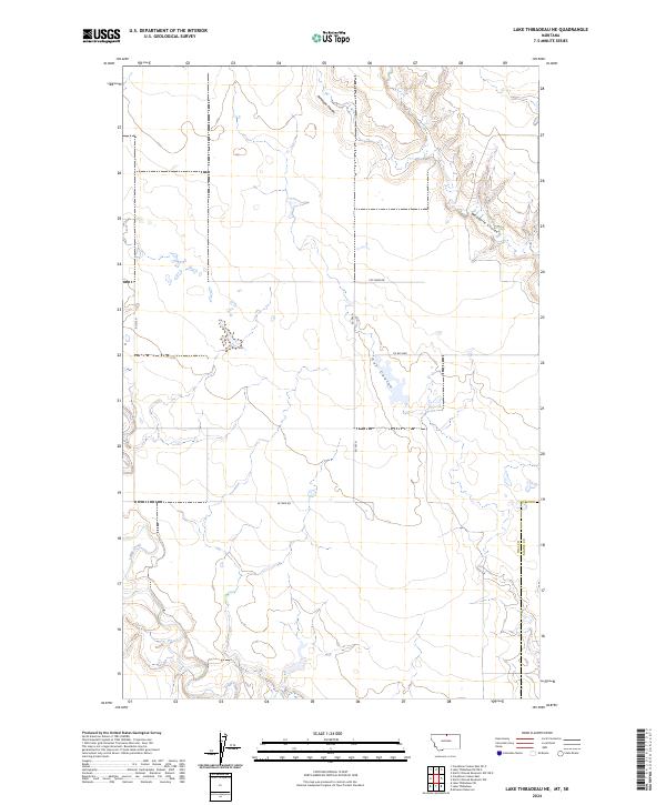
2024 Map of Lake Thibadeau NE
USGS Topo · Published 2024About this map
Lodge Creek meanders across the southern portion of this landscape, marking a prominent hydrological feature in the northern Montana plains. The topography is defined by significant drainage patterns, most notably the winding paths of Antelope Coulee, Woodpile Coulee, and Hay Coulee. This 2024 survey documents a sparsely populated agricultural region where the boundary between Hill Co and Blaine Co runs along the eastern edge. A network of rural corridors, including W Fork Rd, Rd 545 N, and Co Rd 3069, provides access to private farmsteads and fields. The presence of Pvt Farm Dr suggests the ongoing reliance on private access routes to manage the vast sectional divisions of the Public Land Survey System that grid this expansive terrain.
Find a feature on this map
17 named features on this map. Tap any name to fly to it.
Don’t see what you’re looking for? This feature index may not catch every label — zoom into the map to look around manually.
Map Details
Editions of this 2024 Lake Thibadeau NE Map
This is the sole edition of this map. No revisions or reprints were ever made.
Other maps of this area

1912 · Zurich
USGS Topo · 1:125,000

1912 · Thibedeau Lake
USGS Topo · 1:125,000

1953 · Havre
USGS Topo · 1:250,000

1957 · Havre
USGS Topo · 1:250,000

1958 · Havre
USGS Topo · 1:250,000
1972 · Lake Thibadeau SW
USGS Topo · 1:24,000
1972 · Lake Thibadeau
USGS Topo · 1:24,000
1972 · Lake Thibadeau NE
USGS Topo · 1:24,000
1972 · Creedman Coulee East
USGS Topo · 1:24,000
1984 · Mc Laren Reservoir
USGS Topo · 1:24,000