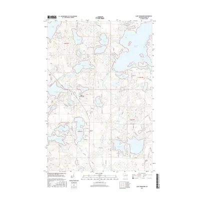
2015 Map of Lake Tomahawk
USGS Topo · Published 2015About this map
Lake Tomahawk sits as a central hub in this water-rich northern landscape, where the Wisconsin River winds past Rainbow Rapids and numerous glacial basins. The 2015 topography reveals a complex network of recreation and residency, with the Rainbow Flowage dominating the northeastern corner and Tomahawk Lake stretching across the west. This area in Oneida County is defined by its high density of named water bodies, including Gilmore Lake, Hasbrook Lake, and Two Sisters Lake, which dictate the winding paths of local routes like Sweeney Lake Rd and Rainbow Lake Rd. Local heritage is anchored by sites such as the Wilderness Rest Cem and Newbold Memorial Cem, while Dolhun Field serves as a distinct landmark near the western edge. The map captures the modern footprint of these Northwoods communities, illustrating how settlement has matured around these vital waterways.
Find a feature on this map
109 named features on this map. Tap any name to fly to it.
Don’t see what you’re looking for? This feature index may not catch every label — zoom into the map to look around manually.
Map Details
Editions of this 2015 Lake Tomahawk Map
This is the sole edition of this map. No revisions or reprints were ever made.
Other maps of this area

1930 · Robbins
USGS Topo · 1:48,000

1938 · Minocqua
USGS Topo · 1:48,000

1938 · Robbins
USGS Topo · 1:48,000

1939 · Cassian
USGS Topo · 1:48,000

1940 · Rhinelander
USGS Topo · 1:48,000

1942 · Cassian
USGS Topo · 1:48,000

1945 · Robbins
USGS Topo · 1:48,000

1946 · Minocqua
USGS Topo · 1:48,000

1949 · Rhinelander
USGS Topo · 1:48,000

1949 · Minocqua
USGS Topo · 1:48,000