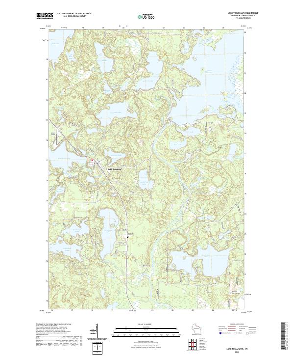
2022 Map of Lake Tomahawk
USGS Topo · Published 2022About this map
Lake Tomahawk sits at the heart of this lake-strewn landscape in Oneida County, serving as the primary settlement among an intricate network of waterways and glaciated terrain. The hydrology of the region is defined by the Wisconsin River, which flows through the eastern portion of the quadrangle, feeding into the Rainbow Flowage and passing the Rainbow Rapids. This 2022 survey documents the density of modern recreation and residential development through an extensive road network including Co Hwy D and Sweeney Lake Rd. Genealogists and local historians will find the Wilderness Rest Cem and Newbold Memorial Cem clearly marked. The map also highlights the distinct separation between larger water bodies like Tomahawk Lake and the smaller, more isolated basins such as Zottle Lake and Cunard Lake, illustrating the post-glacial topography of the Wisconsin Northwoods.
Find a feature on this map
106 named features on this map. Tap any name to fly to it.
Don’t see what you’re looking for? This feature index may not catch every label — zoom into the map to look around manually.
Map Details
Editions of this 2022 Lake Tomahawk Map
This is the sole edition of this map. No revisions or reprints were ever made.
Other maps of this area

1930 · Robbins
USGS Topo · 1:48,000

1938 · Minocqua
USGS Topo · 1:48,000

1938 · Robbins
USGS Topo · 1:48,000

1939 · Cassian
USGS Topo · 1:48,000

1940 · Rhinelander
USGS Topo · 1:48,000

1942 · Cassian
USGS Topo · 1:48,000

1945 · Robbins
USGS Topo · 1:48,000

1946 · Minocqua
USGS Topo · 1:48,000

1949 · Rhinelander
USGS Topo · 1:48,000

1949 · Minocqua
USGS Topo · 1:48,000