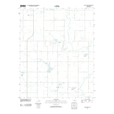
2010 Map of Lake Valley
USGS Topo · Published 2010About this map
The Washita River and its western branch, the West Washita River, meander through this rural section of Oklahoma, defining a landscape shaped by water management and agricultural preservation. Numerous watershed structures, including the Oak Creek Site 9 Reservoir and the Oak Creek Site 5 Reservoir, illustrate a systematic approach to flood control and water storage across the Oak Creek drainage. These reservoirs are often paired with engineering works such as the Oak Creek Site 9 Dam.
Find a feature on this map
41 named features on this map. Tap any name to fly to it.
Don’t see what you’re looking for? This feature index may not catch every label — zoom into the map to look around manually.
Map Details
Editions of this 2010 Lake Valley Map
This is the sole edition of this map. No revisions or reprints were ever made.
Other maps of this area

1955 · Clinton
USGS Topo · 1:250,000

1956 · Cordell
USGS Topo · 1:62,500

1957 · Clinton
USGS Topo · 1:250,000

1961 · Gotebo
USGS Topo · 1:62,500

1961 · Eakly
USGS Topo · 1:62,500

1961 · Carnegie
USGS Topo · 1:62,500
1983 · Cordell
USGS Topo · 1:24,000

1983 · Cloud Chief
USGS Topo · 1:24,000

1984 · Gotebo East
USGS Topo · 1:24,000
1984 · Colony
USGS Topo · 1:24,000