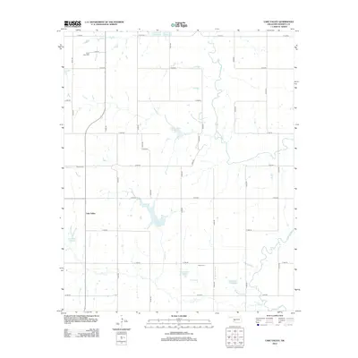
2012 Map of Lake Valley
USGS Topo · Published 2012About this map
The Lake Valley area of Washita County is defined by its complex network of water management sites and agricultural grid. This survey reveals a landscape transformed by numerous flood control structures, including Oak Cr Site 5 Reservoir, Oak Cr Site 10 Reservoir, and Oak Cr Site 8 Reservoir, which dot the drainages of Oak Cr and the Washita River. These man-made features sit alongside natural watercourses such as Wild Cat Cr and Trail Elk Cr, illustrating the intensive rural development of the early 21st century.
Find a feature on this map
38 named features on this map. Tap any name to fly to it.
Don’t see what you’re looking for? This feature index may not catch every label — zoom into the map to look around manually.
Map Details
Editions of this 2012 Lake Valley Map
This is the sole edition of this map. No revisions or reprints were ever made.
Other maps of this area

1955 · Clinton
USGS Topo · 1:250,000

1956 · Cordell
USGS Topo · 1:62,500

1957 · Clinton
USGS Topo · 1:250,000

1961 · Gotebo
USGS Topo · 1:62,500

1961 · Eakly
USGS Topo · 1:62,500

1961 · Carnegie
USGS Topo · 1:62,500
1983 · Cordell
USGS Topo · 1:24,000

1983 · Cloud Chief
USGS Topo · 1:24,000

1984 · Gotebo East
USGS Topo · 1:24,000
1984 · Colony
USGS Topo · 1:24,000