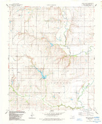
1984 Map of Lake Valley
USGS Topo · Published 1985About this map
Washita River meanders through the eastern portion of this mid-1980s survey, defining the rugged drainage patterns of central Washita County. The landscape is a transition from the rolling uplands near the Lake Valley settlement to the concentrated water resources at Lake Vanderwork, which features a dedicated Boat Ramp for local access. The agricultural and rural character of the era is evidenced by the section-line roads connecting remote landmarks like Sharon Church and various energy interests, including a localized Gas Well.
Find a feature on this map
16 named features on this map. Tap any name to fly to it.
Don’t see what you’re looking for? This feature index may not catch every label — zoom into the map to look around manually.
Map Details
Editions of this 1984 Lake Valley Map
This is the sole edition of this map. No revisions or reprints were ever made.
Other maps of this area

1955 · Clinton
USGS Topo · 1:250,000

1956 · Cordell
USGS Topo · 1:62,500

1957 · Clinton
USGS Topo · 1:250,000

1961 · Gotebo
USGS Topo · 1:62,500

1961 · Eakly
USGS Topo · 1:62,500

1961 · Carnegie
USGS Topo · 1:62,500
1983 · Cordell
USGS Topo · 1:24,000

1983 · Cloud Chief
USGS Topo · 1:24,000

1984 · Gotebo East
USGS Topo · 1:24,000
1984 · Colony
USGS Topo · 1:24,000