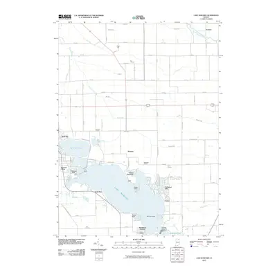
2010 Map of Lake Wawasee
USGS Topo · Published 2010About this map
Lake Wawasee dominates this Indiana landscape, surrounded by a dense network of lakeside developments and residential settlements including Syracuse, Wawasee Village, and Enchanted Hills. The 2010 shoreline is characterized by complex inlets like Johnson Bay and Conklin Bay, while numerous islands such as Ogden Island and Morrison Island dot the water. A robust system of drainage ditches and creeks, including Solomon Creek and the Elkhart River in the northeast, reflects the intensive water management of the surrounding Kosciusko County agricultural lands.
Find a feature on this map
67 named features on this map. Tap any name to fly to it.
Don’t see what you’re looking for? This feature index may not catch every label — zoom into the map to look around manually.
Map Details
Editions of this 2010 Lake Wawasee Map
This is the sole edition of this map. No revisions or reprints were ever made.
Other maps of this area

1950 · Leesburg
USGS Topo · 1:24,000

1950 · North Webster
USGS Topo · 1:24,000

1951 · Milford
USGS Topo · 1:24,000

1951 · Wawasee
USGS Topo · 1:24,000

1951 · Ormas
USGS Topo · 1:24,000

1953 · Fort Wayne
USGS Topo · 1:250,000

1956 · Fort Wayne
USGS Topo · 1:250,000

1956 · Ligonier
USGS Topo · 1:24,000

1959 · Topeka
USGS Topo · 1:24,000

1959 · Millersburg
USGS Topo · 1:24,000