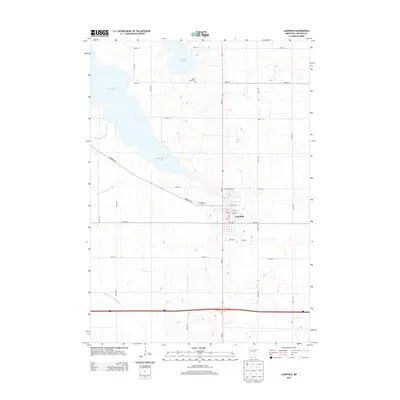
2013 Map of Lakefield
USGS Topo · Published 2013About this map
Lakefield anchors this Jackson County landscape, situated at the intersection of MN-86 and 820th St. The town's grid is detailed with residential streets and local landmarks including the Po and Immanuel Cem. To the north and west, the terrain is defined by the expansive waters of South Heron Lake and the smaller Lake Flaherty, which are connected to a sophisticated water management system of drainage canals like Judicial Ditch Number Seventeen and County Ditch Number Eleven. This network of ditches illustrates the historical effort to manage the high water table of the prairie pothole region for agricultural use. Rural heritage is preserved in sites like the Heron Lake Cem, located north of town near the section lines that define the region's rectilinear road network of avenues and streets.
Find a feature on this map
32 named features on this map. Tap any name to fly to it.
Don’t see what you’re looking for? This feature index may not catch every label — zoom into the map to look around manually.
Map Details
Editions of this 2013 Lakefield Map
This is the sole edition of this map. No revisions or reprints were ever made.
Other maps of this area

1954 · Fairmont
USGS Topo · 1:250,000

1958 · Fairmont
USGS Topo · 1:250,000

1960 · Okabena
USGS Topo · 1:24,000

1960 · Sioux Valley
USGS Topo · 1:24,000

1970 · Lakefield SW
USGS Topo · 1:24,000

1970 · Lakefield NE
USGS Topo · 1:24,000

1970 · Wilder
USGS Topo · 1:24,000

1970 · Lakefield SE
USGS Topo · 1:24,000

1970 · Lakefield
USGS Topo · 1:24,000

1970 · Windom
USGS Topo · 1:24,000