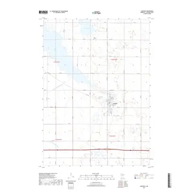
2019 Map of Lakefield
USGS Topo · Published 2019About this map
Lakefield serves as the central hub of this prairie landscape, where the town's street grid, featuring names like Douglas St, meets a network of rural county roads. The surrounding Jackson County terrain is defined by its complex hydrology, dominated by the expansive waters of South Heron Lake and Lake Flaherty. The transformation of the natural landscape for agriculture is evident in the engineered waterways of Judicial Ditch Number Three and County Ditch Number Eleven, which cut across the township lines of t103n r37w and t102n r37w. For those researching local family history, the map preserves the locations of Heron Lake Cem and Immanuel Cem, situated north of the town center. This survey provides a clear view of the modern infrastructure and drainage systems that support this agricultural region of southern Minnesota.
Find a feature on this map
51 named features on this map. Tap any name to fly to it.
Don’t see what you’re looking for? This feature index may not catch every label — zoom into the map to look around manually.
Map Details
Editions of this 2019 Lakefield Map
This is the sole edition of this map. No revisions or reprints were ever made.
Other maps of this area

1954 · Fairmont
USGS Topo · 1:250,000

1958 · Fairmont
USGS Topo · 1:250,000

1960 · Okabena
USGS Topo · 1:24,000

1960 · Sioux Valley
USGS Topo · 1:24,000

1970 · Lakefield SW
USGS Topo · 1:24,000

1970 · Lakefield NE
USGS Topo · 1:24,000

1970 · Wilder
USGS Topo · 1:24,000

1970 · Lakefield SE
USGS Topo · 1:24,000

1970 · Lakefield
USGS Topo · 1:24,000

1970 · Windom
USGS Topo · 1:24,000