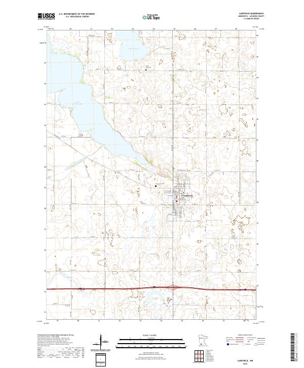
2022 Map of Lakefield
USGS Topo · Published 2022About this map
Lakefield anchors this landscape in Jackson County, showing its grid of streets such as Broadway Ave and Menage Ave N. The surrounding prairie is defined by a rigorous section-line road network and a sophisticated drainage system that includes Judicial Ditch Number Three and Judicial Ditch Number Eleven, reflecting the intensive agricultural development of this southern Minnesota region. To the north, the waters of South Heron Lake and Lake Flaherty interrupt the agricultural blocks, providing a natural contrast to the surveyed landscape. Genealogists can identify local burial sites at Immanuel Cem near the town center and Heron Lake Cem further north. This modern survey illustrates how traditional townships like t103n r36w maintain their structured character while modern highways like Co Hwy 14 facilitate contemporary transit through the rural heartland.
Find a feature on this map
36 named features on this map. Tap any name to fly to it.
Don’t see what you’re looking for? This feature index may not catch every label — zoom into the map to look around manually.
Map Details
Editions of this 2022 Lakefield Map
This is the sole edition of this map. No revisions or reprints were ever made.
Other maps of this area

1954 · Fairmont
USGS Topo · 1:250,000

1958 · Fairmont
USGS Topo · 1:250,000

1960 · Okabena
USGS Topo · 1:24,000

1960 · Sioux Valley
USGS Topo · 1:24,000

1970 · Lakefield SW
USGS Topo · 1:24,000

1970 · Lakefield NE
USGS Topo · 1:24,000

1970 · Wilder
USGS Topo · 1:24,000

1970 · Lakefield SE
USGS Topo · 1:24,000

1970 · Lakefield
USGS Topo · 1:24,000

1970 · Windom
USGS Topo · 1:24,000