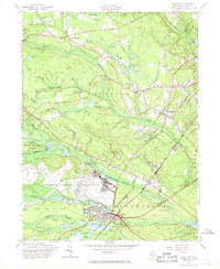
1957 Map of Lakehurst
USGS Topo · Published 1968About this map
Lakehurst Naval Air Station dominates the central landscape of this mid-century survey, surrounded by the intricate hydrology and agriculture of Ocean County. Numerous Cranberry Bogs are scattered throughout the lowlands, particularly along the Ridgeway Branch and Manapaqua Brook, signaling the region's specialized farming heritage. The settlement of Lakehurst sits at a nexus of transportation, where the C RR of N J rail lines and roads like Central Rd connect the town to residential developments like Pine Lake Park.
Find a feature on this map
43 named features on this map. Tap any name to fly to it.
Don’t see what you’re looking for? This feature index may not catch every label — zoom into the map to look around manually.
Map Details
Editions of this 1957 Lakehurst Map
Other maps of this area

1884 · Whitings
USGS Topo · 1:62,500

1888 · Barnegat
USGS Topo · 1:62,500

1888 · Asbury Park
USGS Topo · 1:62,500

1888 · Cassville
USGS Topo · 1:62,500

1888 · Whitings
USGS Topo · 1:62,500

1893 · Asbury Park
USGS Topo · 1:62,500

1893 · Barnegat
USGS Topo · 1:62,500

1894 · Cassville
USGS Topo · 1:62,500

1898 · Barnegat
USGS Topo · 1:62,500

1900 · Cassville
USGS Topo · 1:62,500
Featured Places
- Toms River, NJ
- Lakewood Township, NJ
- Jackson Township, NJ
- Manchester Township, NJ
- Pine Lake Park, Manchester Township