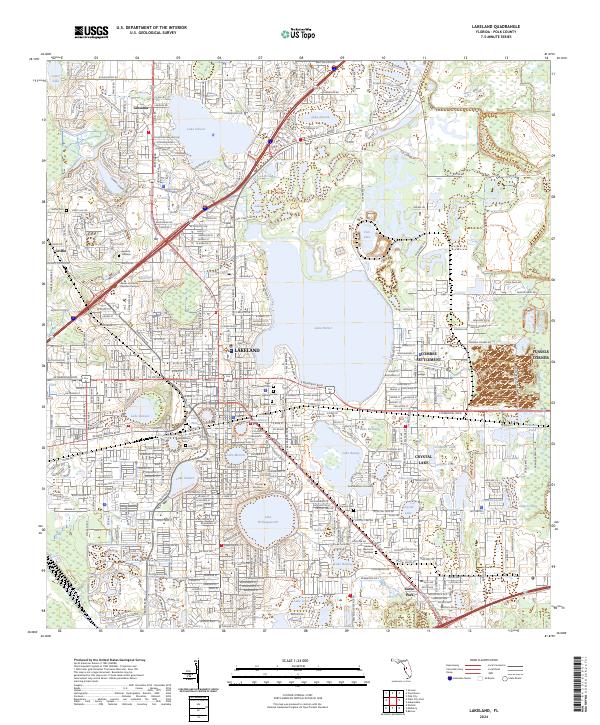
2024 Map of Lakeland
USGS Topo · Published 2024About this map
Lakeland's distinctive urban geography is defined by a dense cluster of lakes that shaped the city's early 21st-century development and educational landscape. Major institutions such as Florida Southern College, Keiser University Lakeland Campus, and Southeastern University are situated among water bodies like Lake Hollingsworth and Lake Parker. The map reveals the intricate connection between transportation and settlement, where the CSX Transportation lines and Interstate 4 intersect with historic areas including Combee Settlement and Fussels Corner. Local history is preserved in several prominent burial grounds like Lakeview Cem and Tiger Flowers Cem, while the northern periphery includes the communities of Gibsonia and Griffin. This record shows a modern Florida city still deeply influenced by its original aquatic hydrology and rail-oriented foundations.
Find a feature on this map
52 named features on this map. Tap any name to fly to it.
Don’t see what you’re looking for? This feature index may not catch every label — zoom into the map to look around manually.
Map Details
Editions of this 2024 Lakeland Map
This is the sole edition of this map. No revisions or reprints were ever made.
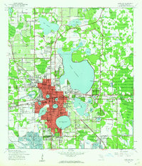
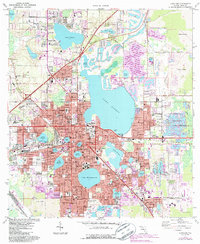
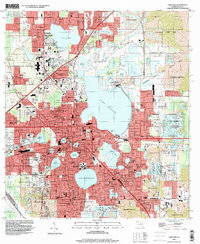
Historical Maps of Eaton Park Through Time
4 maps found