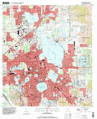
1994 Map of Lakeland
USGS Topo · Published 2000About this map
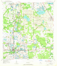
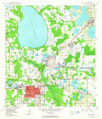
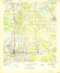
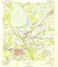
Lakeland's character in the mid-1990s is defined by its numerous water bodies and the extensive landscape reclamation following phosphate mining operations. The urban core is tightly packed around Lake Mirror, Lake Morton, and Lake Wire, featuring institutions like the Polk Museum and Florida Southern college. Surrounding the city, the legacy of the local extraction industry is visible in the vast Reclaimed Strip Mines that have been transformed into recreational and conservation spaces. To the northeast, the Tenoroc State Fish and Wildlife Mgmt Area covers a significant portion of this former industrial ground, while Saddle Creek County Park offers a similar transition from mining to public use. Residential growth extends north to Gibsonia and west toward Griffin, while the massive Lake Parker remains a dominant geographical fixture east of the downtown center.
Find a feature on this map
95 named features on this map. Tap any name to fly to it.
Don’t see what you’re looking for? This feature index may not catch every label — zoom into the map to look around manually.
Map Details
Editions of this 1994 Lakeland Map
This is the sole edition of this map. No revisions or reprints were ever made.
Other maps of this area

1944 · Plant City
USGS Topo · 1:31,680
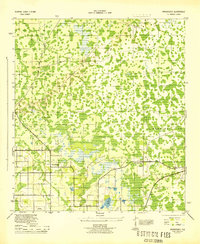
1944 · Providence
USGS Topo · 1:31,680
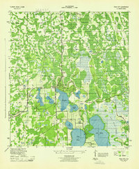
1944 · Polk City
USGS Topo · 1:31,680

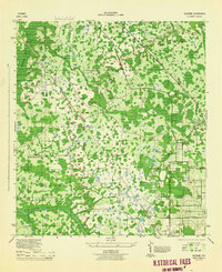
1944 · Lakeland
USGS Topo · 1:31,680

1944 · Auburndale
USGS Topo · 1:31,680
1944 · Socrum
USGS Topo · 1:31,680
1949 · Mulberry
USGS Topo · 1:24,000
1949 · Bartow
USGS Topo · 1:24,000
1950 · Mulberry
USGS Topo · 1:24,000
1950 · Bartow
USGS Topo · 1:24,000