
1944 Map of Polk City
USGS Topo · Published 1944About this map
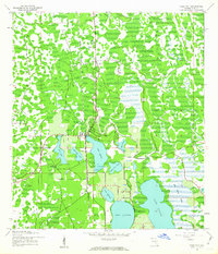
Polk City sits as a central hub for transportation and water resources in the heart of Florida's lake country during the mid-1940s. The settlement pattern is closely tied to the surrounding topography, with residential blocks oriented near the northern shore of Lake Helene. This survey, conducted by the U.S. Coast and Geodetic Survey, emphasizes the region's complex hydrological network, where numerous small basins and larger lakes defined the local geography before extensive modern development. The landscape is characterized by a mix of marshland, orchards, and scattered brush, reflecting an era when citrus production and natural wetlands were the primary features of the rural environment.
Find a feature on this map
2 named features on this map. Tap any name to fly to it.
Don’t see what you’re looking for? This feature index may not catch every label — zoom into the map to look around manually.
Map Details
Editions of this 1944 Polk City Map
2 editions found
Other maps of this area

1944 · Providence
USGS Topo · 1:31,680

1944 · Lakeland
USGS Topo · 1:31,680

1944 · Auburndale
USGS Topo · 1:31,680

1955 · Orlando
USGS Topo · 1:250,000

1957 · Orlando
USGS Topo · 1:250,000

1958 · Orlando
USGS Topo · 1:250,000

1959 · Gum Lake
USGS Topo · 1:24,000

1959 · Lake Louisa SW
USGS Topo · 1:24,000

1959 · Poyner
USGS Topo · 1:24,000
1959 · Winter Haven
USGS Topo · 1:24,000